14.2. Bangladesh Dhaka flood risk assessment on 30 meters,Risk#
This 10-meter fine-scale flood hazard, sensitivity, vulnerability, and risk assessment dataset for Dhaka, Bangladesh, uses river network density, elevation, slope, and vegetation cover to assess the sensitivity of the environment that harbors the hazard; and mean annual rainfall, number of consecutive days of rainfall, and historical peak rainfall as indicators of hazard for assessing hazard-causing factors; The vulnerability of hazard-bearing agents is evaluated using data on population density, road network density, land use type, and lighting; a thorough risk assessment is conducted by combining hazard, sensitivity, and vulnerability and creating a dataset product of hazard, sensitivity, vulnerability, and risk. With a spatial resolution of 30 meters, the dataset's spatial area is the city of Dhaka, Bangladesh. Spatial reference: GCS_WGS_1984. Data source: Institute of Geographic Sciences and Natural Resources Research, CAS
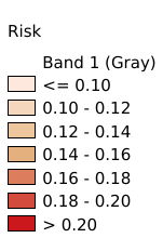
Legend:#
Information:#
Path : /pb1/gisws/qgis_pub_map/svr_w24/shenjl_rsync/ch80_shenjl/sec20_DRR_2023/Dhaka_Floods/pub_Dhaka_Flood_risk_assessment.qgz
Layer Name : pub_Dhaka_Floods_Risk_qn8573
Layer ID : qn8573
Center : 23.784096, 90.419876
Zoom : 11