13.3. DEM of Myanmar#
An international project carried out by NASA from 11 to 22 February 2000 on board the Space Shuttle Endeavour. The mission collected more than 80% of the surface radar data covering the range from 60°N to 56°S by radar interferometry for using in generating near-global land elevation data products.Data source:NASA .Data format tif, spatial coordinate system WGS 84, mapping time 2025-03-31, cartographer Shen Jinlu.
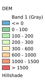
Legend:#
Information:#
Path : /pb1/gisws/qgis_pub_map/svr_w24/shenjl_rsync/ch80_shenjl/sec16_Myanmar_earthquake/dataset_DEM_of_Myanmar_tt/pub_Myanmar_DEM.qgz
Layer Name : pub_Myanmar_DEM_qn2967
Layer ID : qn2967
Center : 18.68375, 96.675
Zoom : 5
Powered by GISLite and Sphinx.