6.56. 2010 Africa Governance index Distribution Map#
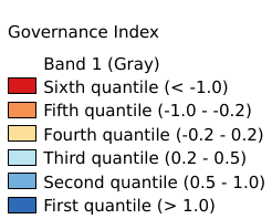
The “governance index” is related to potential effectiveness of any governmental response during and after exposure to climate stress in 2010. Generally well-structured governmental institutions are able to enhance the resilience of its members and citizen promoting adaptation strategies and action. The index results from the first cluster of the Principal Component Analysis preformed among 18 potential variables. The analysis identifies seven dominant variables, namely “openness to external assistance”, “regulatory quality”, “government effectiveness”, “voice and accountability”, “failed state”, “perceived corruption” and “criminal rate”, assigning equal weight of 0.1525 except to “criminal rate” that retrieve a weight of 0.085. Before to perform the analysis “criminal rate” was log transformed to shorten the extreme variation and then all variables were score-standardized (converted to distribution with average of 0 and standard deviation of 1; inverse method was applied for “criminal rate”) in order to be comparable. All the variables are country base and the tabular data were linked by country to the national boundaries shapefile (FAO/GAUL) and then converted into raster format (resolution 0.5 arc-minute). Coordinate system: WGS 84. Data source: https://data.apps.fao.org/map/catalog/srv/eng/catalog.search#/metadata/163b8baa-3e3d-4a40-b10d-312e6226f773
Legend:#
Information:#
Path : /pb1/gisws/qgis_pub_map/svr_w24/shenjl_rsync/ch80_shenjl/sec09_Social_Economic/ClimAfr26_governance_index/pub_Afr_governance_index.qgz
Layer Name : pub_Afr_governance_index_qn5263
Layer ID : qn5263
Center : 1.25, 17.004168
Zoom : 3