4.9. Yangtze River Basin Study#
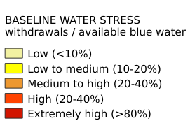
The Yangtze River is the longest river in China, running for over 4,000 miles (6,300 km) through 19 provinces in Southern China. The Yangtze basin typically experiences a rainy summer monsoon season, which can lead to flooding. The Yangtze is a major development area for China, and is already home to 40% of the country’s total GDP. Most of the water use in the basin is for irrigation, primarily for water-intensive rice production.The Yangtze River Basin Study focuses on the specific characteristics of the indicator data and calculation in the Yangtze River Basin. Coordinate system: WGS 84. Data source: https://www.wri.org/data/yangtze-river-basin-study
Legend:#
Information:#
Path : /pb1/gisws/qgis_pub_map/svr_w24/shenjl_rsync/ch80_shenjl/sec07_Water_Resources/Yangtze_River_Basin_Study/pub_YangtzeRiver_BWS.qgz
Layer Name : pub_YangtzeRiver_BWS_qn4087
Layer ID : qn4087
Center : 30.116909, 105.47846
Zoom : 5