12.29. Digital Soil Map of the Morocco#
Morocco has diverse types of landforms and fertile soil. This dataset is made by using the water distribution data downloaded from Food and Agriculture Organization of the United Nations official . Data were obtained by clipping. With the help of ArcGIS software, it can be sorted, cut and synthesized. Data source: https://www.fao.org/soils-portal/data-hub/soil-maps-and-databases/faounesco-soil-map-of-the-world/en/
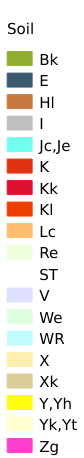
Legend:#
Information:#
Path : /pb1/gisws/qgis_pub_map/svr_w24/shenjl_rsync/ch80_shenjl/sec15_Morocco_Earthquake/dataset_Digital_Soil_Map_of_the_Morocco_tt/pub_Morocco_Soil.qgz
Layer Name : pub_Morocco_Soil_qn8951
Layer ID : qn8951
Center : 31.796707, -7.0686536
Zoom : 6
Powered by GISLite and Sphinx.