6.59. 2010 Africa Rurality Index Distribution Map#
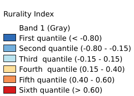
The “rurality index” represents the level of dependence, thus fragility, of a certain region to agriculture and rural means of livelihood in 2010. A population strongly dependent from agriculture is subject to suffer larger consequences from agriculture productivity drop due to climatic alteration than a population less dependent by rural livelihood means. The index results from the first cluster of the Principal Component Analysis preformed among 14 potential variables. The analysis identify four dominant variables, namely “rural population density”, “dietary supply”, “dependency ratio” and “agriculture share GDP”, assigning a weight of 0.22 to the “rural population density” and 0.26 to the other three variables. Before to perform the analysis the variable “rural population density” was log transformed to shorten the extreme variation and then with the other variables were score-standardized (converted to distribution with average of 0 and standard deviation of 1; “dietary supply” with inverse method) in order to be comparable. Data in raster format (resolution 0.5 arc-minute). Coordinate system: WGS 84. Data source: https://data.apps.fao.org/map/catalog/srv/eng/catalog.search#/metadata/57050fff-8a15-4ec5-acb5-069047c9d149
Legend:#
Information:#
Path : /pb1/gisws/qgis_pub_map/svr_w24/shenjl_rsync/ch80_shenjl/sec09_Social_Economic/ClimAfr13_rurality_index/pub_Afr_rurality_index.qgz
Layer Name : pub_Afr_rurality_index_qn4725
Layer ID : qn4725
Center : 1.25, 17.004168
Zoom : 3