3.3. 2000 Global Pasture Distribution Map#
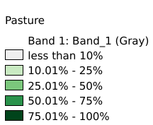
The Global Pastures data set represents the proportion of land areas used as pasture land (land used to support grazing animals) in the year 2000. Satellite data from Modetate Resolution Imaging Spectroradiometer (MODIS) and Satellite Pour l'Observation de la Terre (SPOT) Image Vegetation sensors were combined with agricultural inventory data to create a global data set. The visual presentation of these data demonstrates the extent to which human land use for agriculture has changed the Earth and in which areas this change is most intense. The data were compiled by Navin Ramankutty et al. (2008) and distributed by the Columbia University Center for International Earth Science Information Network (CIESIN). Coordinate system: WGS 84. Data source: https://sedac.ciesin.columbia.edu/data/set/aglands-pastures-2000
Legend:#
Information:#
Path : /pb1/gisws/qgis_pub_map/svr_w24/shenjl_rsync/ch80_shenjl/sec06_Terrestrid_Surface/2000_global_pastures/pub_2000_global_pastures.qgz
Layer Name : pub_2000_global_pastures_qn3698
Layer ID : qn3698
Center : -0.00549, -165.00092
Zoom : 1