13.6. Landsat image of the earthquake zone in Myanmar#
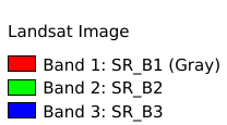
The dataset is a Landsat 8 multispectral image before the earthquake in Myanmar, with a spatial resolution of 30m, and the data has been declouded, devapored and mosaic by the GEE platform.Data source:USGS(earthexplorer.usgs.gov).Data format tif, spatial coordinate system WGS 84, mapping time 2025-04-01, cartographer Shen Jinlu.
Legend:#

Information:#
Path : /pb1/gisws/qgis_pub_map/svr_w24/shenjl_rsync/ch80_shenjl/sec16_Myanmar_earthquake/dataset_Landsat_image_earthquake_zone_Myanmar/pub_Myanmar_Landsat_Image.qgz
Layer Name : pub_Myanmar_Landsat_Image_qn1480
Layer ID : qn1480
Center : 22.049913, 95.840225
Zoom : 10
Powered by GISLite and Sphinx.