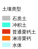
9.165. 色楞格河流域土壤分布图#
矢量数据集基于粮农组织-教科文组织世界土壤地图。比例为 1:5.000.000 的世界数字化土壤地图,通过裁剪得到色楞格河流域土壤分布数据。数据来源(https://data.apps.fao.org/map/catalog/srv/eng/catalog.search#/metadata/446ed430-8383-11db-b9b2-000d939bc5d8)。
Legend:#
Information:#
Path : /pb1/gisws/qgis_pub_map/svr_w24/shenjl_rsync/ch80_shenjl/sec12_Selenga_River/Selenga_River_soil/pub_Selenga_River_soil.qgz
Layer Name : pub_Selenga_River_soil_qn6942
Layer ID : qn6942
Center : 49.10361, 102.84167
Zoom : 6
Powered by GISLite and Sphinx.