13.17. Spatial distribution of the Myanmar population#
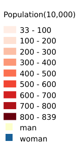
This dataset is based on a report by The Mirror of Myanmar on 2 April, in which the Population Division of the Ministry of Labour, Immigration and Population of Myanmar calculates and publishes the total population of the whole country as at 1 April 2020, together with the population of each division and state, on the basis of data from the 2014 national census.Data source:https://m.mofcom.gov.cn/article/i/jyjl/j/202004/20200402951774.shtml.Data format shapefile, spatial coordinate system WGS 84, mapping time 2025-04-01, cartographer Shen Jinlu.
Legend:#
Information:#
Path : /pb1/gisws/qgis_pub_map/svr_w24/shenjl_rsync/ch80_shenjl/sec16_Myanmar_earthquake/dataset_Spatial_distribution_of_the_Myanmar_population_tt/pub_Myanmar_population_distribution.qgz
Layer Name : pub_Myanmar_population_distribution_qn2734
Layer ID : qn2734
Center : 18.683853, 96.674644
Zoom : 5