13.9. Spatial distribution of buildings in Myanmar#
The data is based on high resolution imagery and deep learning segmentation algorithms to obtain information on building contours across Myanmar. The data can show the spatial distribution of buildings and contains height information. The data format is vector shapefile with high accuracy.Data source: https://zenodo.org/records/11397015.Data format shapefile, spatial coordinate system WGS 84, mapping time 2025-04-02, cartographer Shen Jinlu.
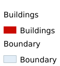
Legend:#

Information:#
Path : /pb1/gisws/qgis_pub_map/svr_w24/shenjl_rsync/ch80_shenjl/sec16_Myanmar_earthquake/dataset_Spatial_distribution_of_buildings_in_Myanmar_tt/pub_Myanmar_buildings_distribution.qgz
Layer Name : pub_Myanmar_buildings_distribution_qn6794
Layer ID : qn6794
Center : 18.683853, 96.674644
Zoom : 5