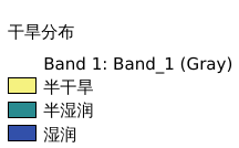
9.159. 色楞格河流域干旱分布图#
数据集为估计的干旱度网格,空间分辨率为 10 弧分。该数据集表示年平均降水量除以平均年潜在蒸散量,是联合国环境规划署(UNEP)定义的干旱指数。通剪裁得到色楞格河流域干旱数据。数据来源(https://data.apps.fao.org/map/catalog/srv/eng/catalog.search#/metadata/221072ae-2090-48a1-be6f-5a88f061431a),空间坐标系为WGS 84。
Legend:#
Information:#
Path : /pb1/gisws/qgis_pub_map/svr_w24/shenjl_rsync/ch80_shenjl/sec12_Selenga_River/Selenga_River_Basin_aridity/pub_Selenga_River_Basin_aridity.qgz
Layer Name : pub_Selenga_River_Basin_aridity_qn7036
Layer ID : qn7036
Center : 49.08343, 102.83354
Zoom : 6
Powered by GISLite and Sphinx.