3.41. Landform and Lithology for Burundi#
The full resolution dataset of landform and lithology has been produced from visual interpretation of digitally enhanced LANDSAT TM images acquired mainly in the year 1999. The landform classes have been developed using the ITC (International Institute for Geo-Information Science and Earth Observation) and SOTER (Soil and Terrain Database) methods. The structure of the derived legend follows a specific criteria that allows and easy correlation between these classes and the standardised one listed in LCCS (SOTER classification first and second level). SOTER is a pure Parametric or Morphometric classification. The main origin or process of terrain units is an important descriptive element because it realtes to the dominant exogenous or endogenous processes. this aspect in a general classification gives a meaningful grouping and has analytical value. The proposed legend is structured in such a way that it can be read, not only from the Morphometric point of view as in SOTER, but also taking into account the main origin and the age of landforms (mainly derived from the lithology legend).Coordinate system: WGS 84. Data source: https://data.apps.fao.org/map/catalog/srv/eng/catalog.search#/metadata/cdaf591c-1ccf-4f20-9762-9dffa12f6065
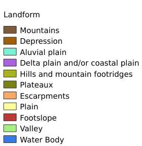
Legend:#
Information:#
Path : /pb1/gisws/qgis_pub_map/svr_w24/shenjl_rsync/ch80_shenjl/sec06_Terrestrid_Surface/Geomorphology_Landform_and_Lithology_for_Burundi_AFRICOVER/pub_landform_bu.qgz
Layer Name : pub_landform_bu_qn3958
Layer ID : qn3958
Center : -3.3890843, 29.925268
Zoom : 8