3.26. Global Dominant Land Cover and Use Distribution Map#
The map summarizes the status of the land use and land cover at global scale. It was compiled according to the current GAEZ (Global Agro-Ecological Zones) -2009 approach, developed by FAO in collaboration with IIASA (International Institute for Applied Systems Analysis).The current Global AEZ (GAEZ-2009) offers a standardized framework for the characterization of climate, soil and terrain conditions relevant to agricultural production, which can be applied at global to sub-national levels. Coordinate system: WGS 84. Data source:https://data.apps.fao.org/map/catalog/srv/eng/catalog.search#/metadata/6c34ec8b-f31e-4976-9344-fd11b738a850
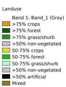
Legend:#
Information:#
Path : /pb1/gisws/qgis_pub_map/svr_w24/shenjl_rsync/ch80_shenjl/sec06_Terrestrid_Surface/Major_global_landuse/pub_dominant_landuse.qgz
Layer Name : pub_dominant_landuse_qn2504
Layer ID : qn2504
Center : 13.833333, -175.26419
Zoom : 2