13.1. Administrative divisions of Myanmar#
The data shows the administrative boundaries of Myanmar, which is divided into seven divisions, seven states and the Union Territory.Data source:https://gadm.org/download_country_v3.html .Data format shapefile, spatial coordinate system WGS 84, mapping time 2025-03-31, cartographer Shen Jinlu.
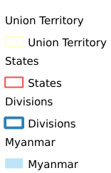
Legend:#
Information:#
Path : /pb1/gisws/qgis_pub_map/svr_w24/shenjl_rsync/ch80_shenjl/sec16_Myanmar_earthquake/dataset_Administrative_divisions_of_Myanmar_tt/pub_Myanmar_Administrative_Divisions.qgz
Layer Name : pub_Myanmar_Administrative_Divisions_qn9845
Layer ID : qn9845
Center : 18.683853, 96.674644
Zoom : 5
Powered by GISLite and Sphinx.