geopandas.GeoSeries.buffer#
- GeoSeries.buffer(distance, resolution=16, **kwargs)#
返回一个
GeoSeries表示给定区域内所有点的几何图形distance每个几何对象的。有关详细信息,请参阅http://shapely.readthedocs.io/en/latest/manual.html#object.buffer。
- 参数
- distanceFloat,np.array,pd.Series
缓冲区的半径。如果使用np.array或pd.Series,则它的长度必须与GeoSeries相同。
- resolution整型(可选,默认为16)
每个顶点周围缓冲区的分辨率。
示例
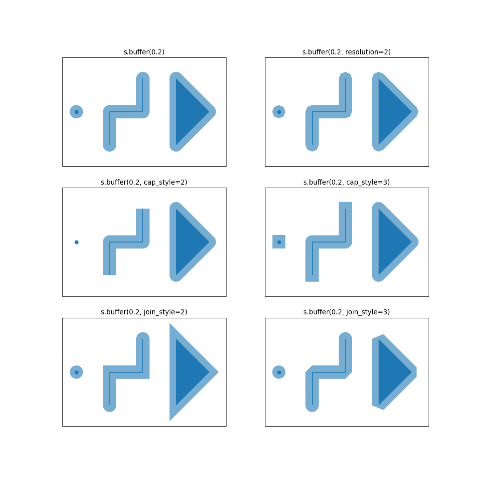
>>> from shapely.geometry import Point, LineString, Polygon
>>> s = geopandas.GeoSeries(
...     [
...         Point(0, 0),
...         LineString([(1, -1), (1, 0), (2, 0), (2, 1)]),
...         Polygon([(3, -1), (4, 0), (3, 1)]),
...     ]
... )
>>> s
0                              POINT (0.00000 0.00000)
1    LINESTRING (1.00000 -1.00000, 1.00000 0.00000,...
2    POLYGON ((3.00000 -1.00000, 4.00000 0.00000, 3...
dtype: geometry
>>> s.buffer(0.2)
0    POLYGON ((0.20000 0.00000, 0.19904 -0.01960, 0...
1    POLYGON ((0.80000 0.00000, 0.80096 0.01960, 0....
2    POLYGON ((2.80000 -1.00000, 2.80000 1.00000, 2...
dtype: geometry
**kwargs接受进一步的规范为join_style和cap_style。请参见不同选项的下图。(Source code _, png , hires.png , pdf )