3.42. Land Use Distribution Map of the China Pakistan Economic Corridor in 2001#
The spatial distribution of land use data in the China Pakistan Economic Corridor region in 2001 was obtained from Finer Resolution Observation and Monitoring - Global Land Cover (tsinghua. edu. cn), with a spatial resolution of 250m , and the spatial coordinate system of WGS 84.
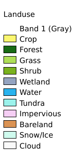
Legend:#
Information:#
Path : /pb1/gisws/qgis_pub_map/svr_w24/local/ch83_cpjrc/sec03_biosphere/2001_2020_CPEC_Landuse/pub_2001_CPEC_landuse.qgz
Layer Name : pub_2001_CPEC_landuse_qn4835
Layer ID : qn4835
Center : 30.901613, 67.35024
Zoom : 4
Powered by GISLite and Sphinx.