2.10. Population density distribution map of the China Pakistan Economic Corridor#
This dataset is the population data of the China-Pakistan Economic Corridor region. It integrates representative data resources such as Wordpop, and compiles the population distribution data of Pakistan with a resolution of 100 meters. The data format is TIFF and the spatial resolution is 100m.
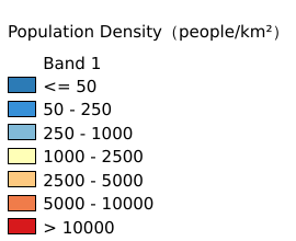
Legend:#
Information:#
Path : /pb1/gisws/qgis_pub_map/svr_w24/local/ch83_cpjrc/sec02_cpjrc/zhongba/pub10_cp_population.qgz
Layer Name : pub_population_qn9127
Layer ID : qn9127
Center : 30.562365, 68.854576
Zoom : 5
Powered by GISLite and Sphinx.