摘要: OpenLayers怎么实现目测 这个例子可以计算两条直线的距离,可以计算多边形的面积。 下面把代码贴出来。 [Java] view plaincopyprint? [JScript] view plaincopyprint? 看到这句话了...
OpenLayers怎么实现目测
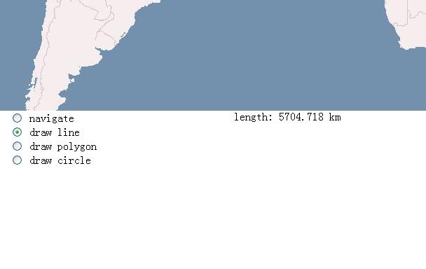
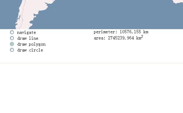
这个例子可以计算两条直线的距离,可以计算多边形的面积。
下面把代码贴出来。
[Java] view plaincopyprint?
[JScript] view plaincopyprint?
看到这句话了吗?OpenLayers版本不同,可能没有这个measure.js。
[JScript] view plaincopyprint? 现在把这个js贴出来,拷贝到您的网站中,这个功能就能实现了。
[JScript] view plaincopyprint?[JScript] view plaincopyprint? / Copyright (c) 2006-2008 MetaCarta, Inc., published under the Clear BSD
license. See http://svn.openlayers.org/trunk/openlayers/license.txt for the
full text of the license. //
@requires OpenLayers/Control.js
@requires OpenLayers/Feature/Vector.js
*//
Class: OpenLayers.Control.Measure
Allows for drawing of features for measurements.
Inherits from:
-/
OpenLayers.Control.Measure = OpenLayers.Class(OpenLayers.Control, {/
APIProperty: handlerOptions
{Object} Used to set non-default properties on the control's handler
*/
handlerOptions: null,/
APIProperty: onMeasure
{Function} After a geometry is drawn, onMeasure is called with three
arguments: the geometry, its length, and its area.
/
onMeasure: function() {},/
Property: callbacks
{Object} The functions that are sent to the handler for callback
*/
callbacks: null,/
Property: displayUnits
{String} Units for output. Must be one of 'in', 'ft', 'mi', 'm', 'km',
or 'dd'. If null, displayUnits will be assumed to be the same as
map units.
*/
displayUnits: null,/
Constructor: OpenLayers.Control.Measure
Parameters:
handler - {}
options - {Object}
/
initialize: function(handler, options) {
OpenLayers.Control.prototype.initialize.apply(this, [options]);
this.callbacks = OpenLayers.Util.extend(
{done: this.measureGeometry, point: this.partialMeasure},
this.callbacks
);
this.handler = new handler(this, this.callbacks, this.handlerOptions);
},/
Method: measureGeometry
/
measureGeometry: function(geometry) {
var area = this.getArea(geometry);
var length = this.getLength(geometry);
this.onMeasure(geometry, length, area, this.displayUnits);
},/
Method: getArea
/
getArea: function(geometry) {
var area = geometry.getArea();
var inPerDisplayUnit = OpenLayers.INCHES_PER_UNIT[this.displayUnits];
if(inPerDisplayUnit) {
var inPerMapUnit = OpenLayers.INCHES_PER_UNIT[this.map.units];
area *= Math.pow((inPerMapUnit / inPerDisplayUnit), 2);
}
return area;
},/
Method: getLength
/
getLength: function(geometry) {
var length = geometry.getLength();
var inPerDisplayUnit = OpenLayers.INCHES_PER_UNIT[this.displayUnits];
if(inPerDisplayUnit) {
var inPerMapUnit = OpenLayers.INCHES_PER_UNIT[this.map.units];
length *= (inPerMapUnit / inPerDisplayUnit);
}
return length;
},CLASS_NAME: "OpenLayers.Control.Measure"
});
