Using open source GIS software in our work
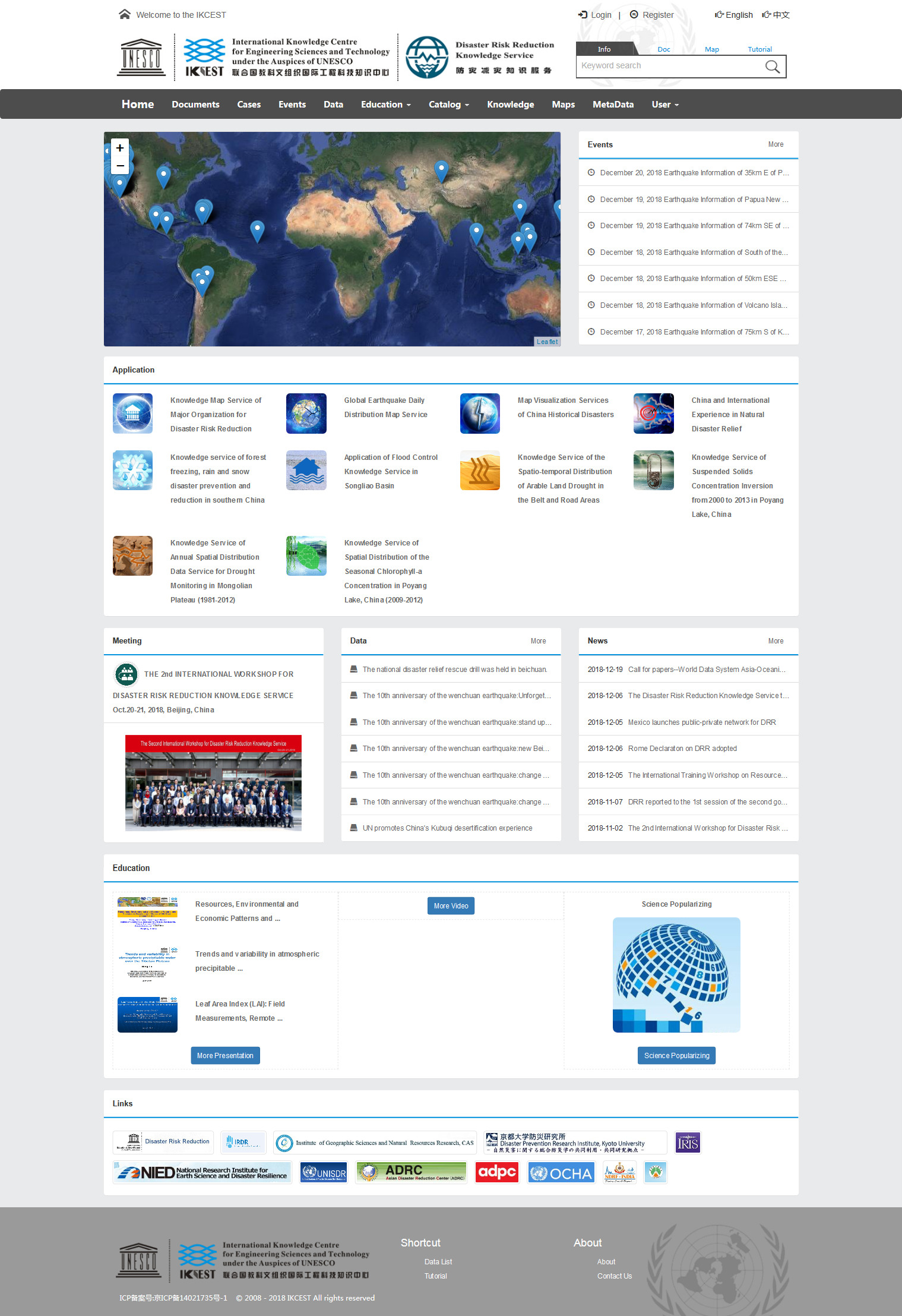
Disaster Risk Reduction Knowledge Service
The project of Disaster Risk Reduction Knowledge Service system is supported by International Knowledge Centre for Engineering Sciences and Technology under the Auspices of UNESCO. The DRR system provides international-oriented knowledge services on disaster risk reduction metadata catalogue, data resources, educational videos and experience cases for different countries and regions.The overall task is undertaken by the Institute of Geographic Sciences and Natural Resources Research of the Chinese Academy of Sciences. The development and testing of the system is completed by the Northeast Institute of Geography and Agroecology, Chinese Academy of Sciences.The oriented users include policy makers, scientific researchers and the public interested in disaster risk reduction in China and surrounding countries and regions.
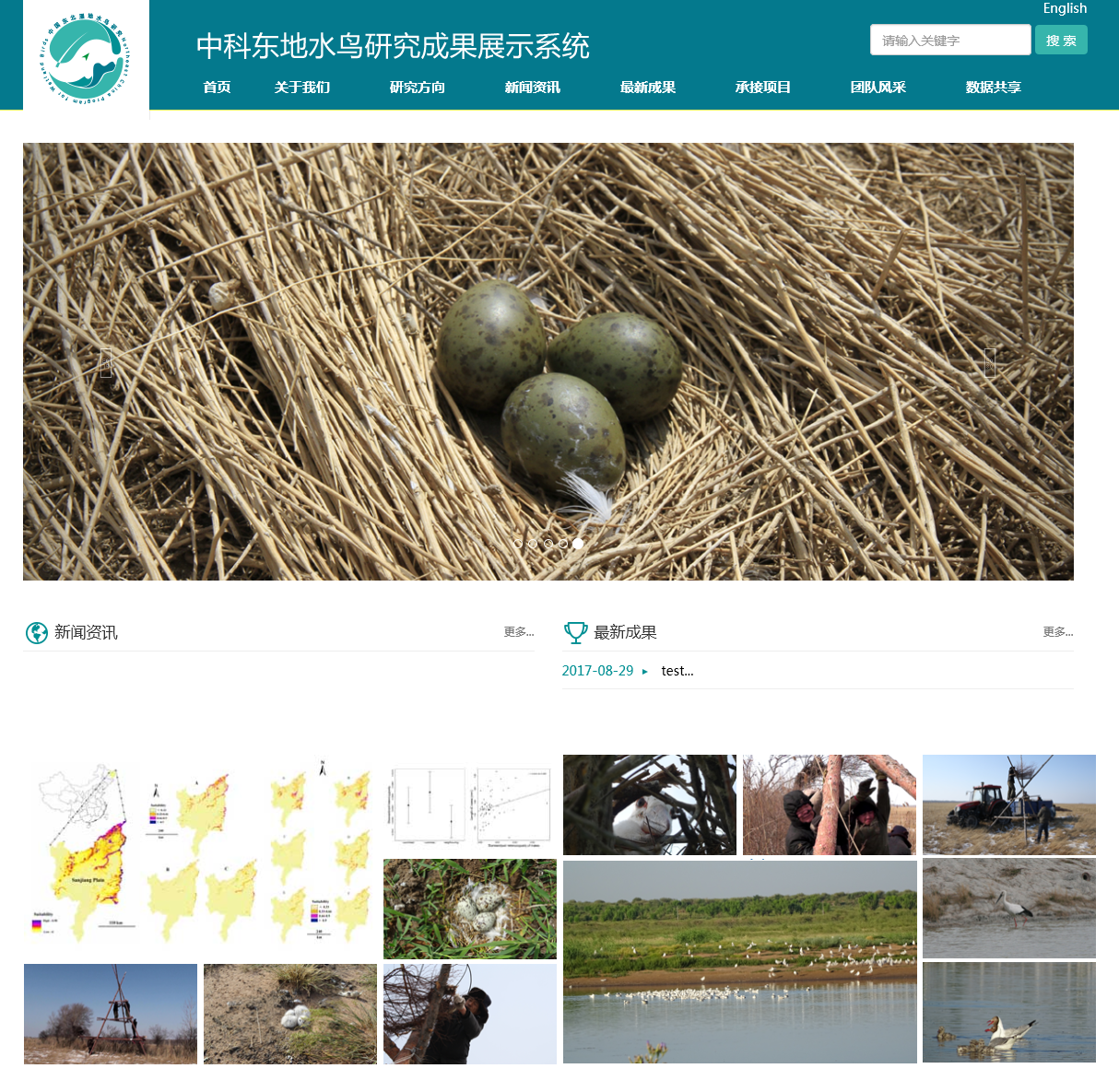
Project of Water Bird Research Demonstration System in Northeast China Wetland
In December 2015, the Northeast Institute of Geography and Agroecology, Chinese Academy of Sciences combined with new forms and tasks and played a cross-disciplinary, cross-sectoral and cross-disciplinary role in the field of wetland research in accordance with its own research characteristics. Joined with Northeast Normal University, a leading regional research unit, to carry out collaborative innovation and build a "Key Laboratory of Wetland Ecology and Environment". The project of Water Bird Research Demonstration System in Northeast China Wetland is one of the important research fields in the construction of "Key Laboratory of Wetland Ecology and Environment". As one of the important links of collaborative innovation, it was first established on December 28, 2015.
"Cooperative Innovation Research Team of Water Bird Research Demonstration System in Northeast China Wetland" is guided by national strategic needs, aiming at maximizing the protection of wetland biodiversity and multi-disciplinary collaborative innovation, taking "school-based collaboration of biology-ecology-landscape-remote sensing-geography" as the path, and guaranteeing the reform of system and mechanism, to comprehensively promote the comprehensive research on the protection of wetland waterbirds biodiversity.
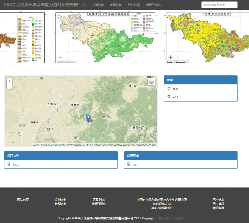
Supporting project of monitoring and early warning for carrying capacity of resources and environment in Jilin Province
Jilin Province Eco-environmental Bearing Capacity Technology Platform provides services such as document publishing, map resource publishing, map visualization application, evaluation formula and so on, realizes the evaluation function of online scientific calculation and environmental calculation, takes map application and index grading calculation as basic units, and equips relatively perfect regional ring on the basis of map application. Context document description. The related online map resources are provided by OSGeo (Open Source Geospatial Foundation) China Center with service interfaces. The network service interfaces conforming to relevant standards and specifications are designed to complete data exchange and interoperability. Users include policy makers, scientific researchers and the public who are interested in the ecological environment in Jilin Province. Users can obtain relevant data and information directly through the Internet and Web browser.
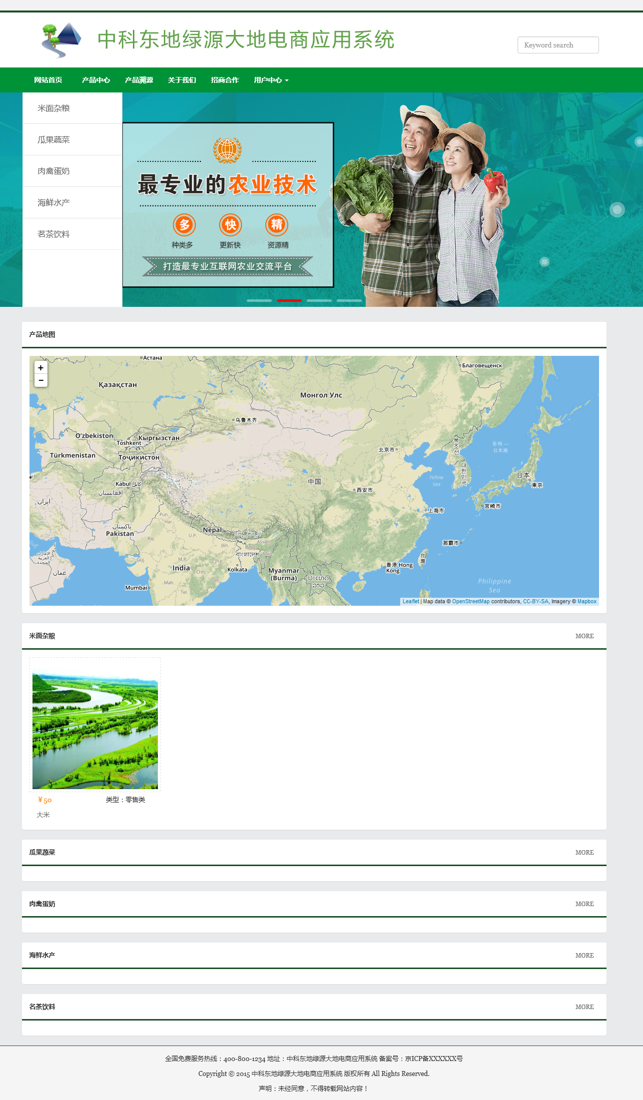
Green Source Geotechnical E-commerce Application System
Green Source Land Platform provides information documents on agricultural products types, latest developments, industry insiders, local websites, investment cooperation and so on. It realizes the visualization function of agricultural products traceable distribution map. Users can obtain relevant map data and information directly through the Internet and Web browser. The related online map resources are provided by OSGeo (Open Source Geospatial Foundation) China Center with service interfaces. The network service interfaces conforming to relevant standards and specifications are designed to complete data exchange and interoperability. Users are oriented to the public who are interested in organic products and green food.
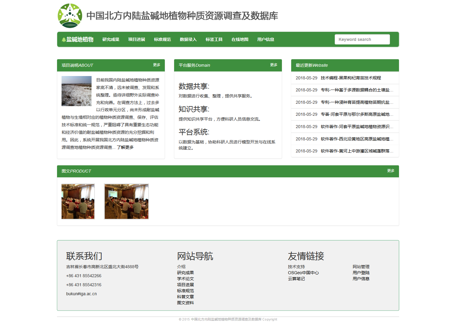
Inland Saline-alkali Plants Germplasm Resources Project in North China
At present, the plant germplasm resources in saline-alkali land in China are not clear, and are far from being investigated, discovered and systematically sorted out. In order to meet the great needs of saline-alkali land management and ecological construction in China, the project of inland saline-alkali land plant germplasm resources in Zhongke East was carried out.
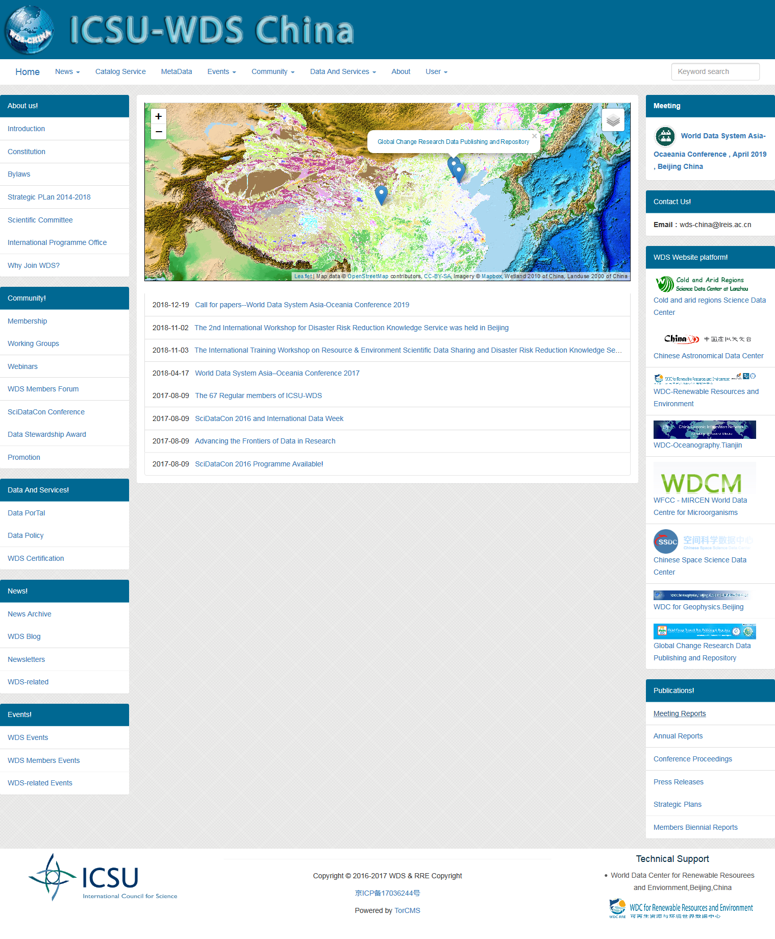
World Data System
The World Data Center (WDC) was founded in 1957 and is an international data organization under the International Council for Science (ICSU). The direct purpose of WDC is to provide data management and sharing services for the International Geophysical Year (IGY) 1957-1958. Due to the success of WDC in data management and service, the system was permanently retained and used for subsequent IGY and more scientific data and information management and sharing services.
At the beginning of its establishment, WDC has 27 data centers, which are concentrated in developed countries such as Europe and the United States. With the development of more than 50 years, it has involved more and more subjects and fields. At present, 51 data centers have been established in the world, which are distributed in the United States, Europe, China, Japan and India. The continuous expansion of WDC system has promoted its scientific data collection, exchange, dissemination and sharing services worldwide, and has gradually become an important force in the field of international data sharing. At the same time, some defects and problems of WDC system itself are gradually magnified with the expansion of WDC system, and ultimately affect the effective organization and long-term operation of the system.
Since the Eleventh Five-Year Plan, the relevant departments of the state have actively implemented the policy of "integration, sharing, perfection and improvement", aiming at strengthening the basic capacity building of scientific and technological innovation, promoting the integration, sharing and efficient utilization of scientific and technological resources in China, changing the situation of multiple management and decentralized investment in the construction of scientific and technological infrastructure in China, reducing the low-level duplication and waste of scientific and technological resources, and breaking the rule of scientific and technological resources. The pattern of block division, Department closure, information retention and data monopoly.
On October 9, 2014, the International Federation of Sciences World Data System (ICSU-WDS) China Secretariat Seminar was held at the Institute of Geographic Science and Resources, Chinese Academy of Sciences. WDS is an international data organization founded in 2008 after the reorganization of the former World Data Center (WDC). Sun Jiulin, former Executive Board of WDC and Secretary-General of WDC China National Committee, former member of WDS Scientific Committee, National People's Congress, Yan Baoping, researcher of Computer Network Information Center of Chinese Academy of Sciences, Chen Mingqi, Director of Informatization Department of Article Finance Bureau of Chinese Academy of Sciences, solemn deputy director of International Cooperation Department of Chinese Academy of Sciences, and now member of WDS Scientific Committee and Institute of Remote Sensing and Digital Earth of Chinese Academy of Sciences. Researcher Li Guoqing, Director Deng Xiangzheng, International Cooperation Department, Institute of Geographic Resources, Chinese Academy of Sciences, Director Zhu Yunqiang, Deputy Director Yang Yaping, Geographic Resources Institute of Chinese Academy of Sciences, Director Zhu Yunqiang, and Vice Director of Geographic Data Science and Sharing Laboratory, WDS China Astronomical Data Center, Ocean Data Center, Cold Area Data Center, Renewable Resources and Environment Data Center, Microbial Data Center, Polar Data Persons or representatives attend the meeting.