5.6. mbstyle工作簿结论
我们希望您喜欢这个造型车间。
其他资源:
5.6.1. mbstyle提示和技巧
5.6.2. mbstyle研讨会答案键
在整个讲习班中列出了以下问题,以此作为更深入探讨材料的机会。在查看这里的答案之前,请尽量仔细考虑这些问题。提供问题以教授有价值的技能,例如有机会了解如何使用要素类型样式来控制z顺序,或在用户手册中的何处查找信息。
备注
马上就来
5.6.2.1. 分类
挑战: 创建新样式根据 type .
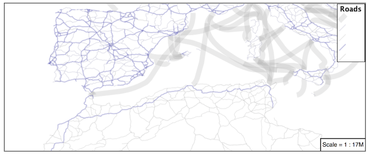
提示:可用值为“主要公路”、“次要公路”、“道路”和“未知”。
下面是一个例子:
 {
  "version": 8,
  "name": "line_example",
  "layers": [
    {
      "id": "line_hwy1",
      "source-layer": "ne:roads",
      "type": "line",
      "filter": ["==", "type", "Major Highway"],
      "paint": {
        "line-color": "#000088",
        "line-width": 1.25,
        "line-opacity": 0.25
      }
    },
    {
      "id": "line_hwy2",
      "source-layer": "ne:roads",
      "type": "line",
      "filter": ["==", "type", "Secondary Highway"],
      "paint": {
        "line-color": "#8888AA",
        "line-width": 0.75,
        "line-opacity": 0.25
      }
    },
    {
      "id": "line_road",
      "source-layer": "ne:roads",
      "type": "line",
      "filter": ["==", "type", "Road"],
      "paint": {
        "line-color": "#888888",
        "line-width": 0.75,
        "line-opacity": 0.25
      }
    },
    {
      "id": "line_unk",
      "source-layer": "ne:roads",
      "type": "line",
      "filter": ["==", "type", "Unknown"],
      "paint": {
        "line-color": "#888888",
        "line-width": 0.5,
        "line-opacity": 0.25
      }
    }
  ]
}
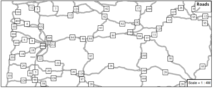
5.6.2.2. 一条规则分类
回答 Challenge One Rule Classification :
挑战: 创建一个新样式,并根据道路的比例等级,在单个规则中使用表达式对道路进行分类,而不是使用过滤器对多个规则进行分类。
本练习需要在MBStyle用户指南中查找信息。
地图盒样式规范 functions 提供详细信息。
5.6.2.3. 标签屏蔽
挑战: 请看一看在SLD中文本符号上放置图形的文档,并用mbstyle复制此技术。
标签屏蔽的使用是geoserver呈现引擎的特定于供应商的功能。本练习的难点在于找出哪些符号布局参数提供了所需的行为,主要是 icon-text-fit 以及允许在标签上绘制文本的各种放置和重叠参数(请参见 symbol layer )
{
  "version": 8,
  "name": "line_example",
  "sprite": "http://localhost:8080/geoserver/styles/sprites",
  "layers": [
    {
      "id": "line_casing",
      "source-layer": "ne:roads",
      "type": "line",
      "paint": {
        "line-color": "#000000",
        "line-width": 3,
      }
    },
    {
      "id": "line_inner",
      "source-layer": "ne:roads",
      "type": "line",
      "paint": {
        "line-color": "#D3D3D3",
        "line-width": 2,
      }
    },
    {
      "id": "label",
      "source-layer": "ne:roads",
      "type": "symbol",
      "layout": {
        "icon-image": "white_square16",
        "icon-text-fit": "width",
        "icon-text-fit-padding": [2, 2, 2, 2],
        "text-field": "{name}",
        "text-font": ["Ariel"],
        "text-font-size": 10,
        "text-ignore-placement": true,
        "text-allow-overlap": true,
        "icon-ignore-placement": true,
        "icon-allow-overlap": true,
        "symbol-placement": "line",
        "symbol-spacing": 0

      }
      "paint": {
        "text-color": "black"
      }
    }
  ]
}
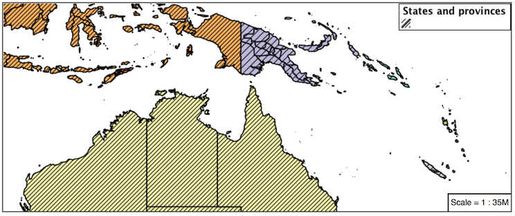
5.6.2.4. 间隔
回答 Explore Interval :
geoserver的令人兴奋的使用 fill-pattern 符号通过改变所使用的模式来设置主题。
探索: 使用 间隔 功能到主题 数据等级 .
例子:
 {
  "version": 8,
  "name": "polygon_example",
  "sprite": "http://localhost:8080/geoserver/styles/sprites",
  "layers": [
    {
      "id": "polygon",
      "source-layer": "ne:states_provinces_shp",
      "type": "fill",
      "paint": {
        "fill-pattern": {
          "property": "datarank",
          "type": "interval",
          "stops": [
            [4, "grey_diag8"],
            [6, "grey_diag16"]
          ]
        }
      }
    }
  ]
}
5.6.2.5. 晕圈
回答 Challenge Halo :
Halo示例将填充颜色和不透明度用于静音Halo,而这提高了可读性,但并未引起标签的注意。
强调的一个常见的设计选择是用对比色勾勒出文本的轮廓。
挑战: 生成一个在黑色文本周围使用白色光环的地图。
下面是一个例子:
{
  "version": 8,
  "name": "polygon_example",
  "layers": [
    {
      "id": "polygon_fill",
      "source-layer": "ne:states_provinces_shp",
      "type": "fill",
      "paint": {
        "fill-color": "#7EB5D3",
        "fill-outline-color": "gray"
      }
    },
    {
      "id": "polygon_label",
      "source-layer": "ne:states_provinces_shp",
      "type": "symbol",
      "layout": {
        "text-field": "{name}",
        "text-anchor": "center"
        "text-max-width": 14,
        "text-font": ["Arial"]
      },
      "paint": {
        "text-color": "white",
        "text-halo-color": "black",
        "text-halo-width": 1

      }
    }
  ]
}
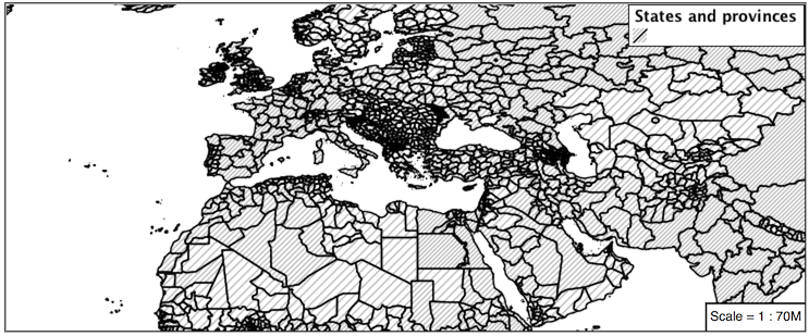
5.6.2.6. 使用多个属性创建主题
回答 Challenge Theming using Multiple Attributes :
一个强大的工具正在使用多个属性创建主题。这是一个重要的概念,允许地图阅读器执行“眼球集成”(检测属性值信息之间的相关性)。
挑战: 结合 地图颜色9 和 数据等级 复制以下地图的示例。
这应该是使用
categorical示例,以及interval已提供示例。{ "version": 8, "name": "polygon_example", "sprite": "http://localhost:8080/geoserver/styles/sprites", "layers": [ { "id": "polygon", "source-layer": "ne:states_provinces_shp", "type": "fill", "paint": { "fill-color": { "property": "mapcolor9", "type": "categorical", "stops": [ [1, "#8dd3c7"], [2, "#ffffb3"], [3, "#bebada"], [4, "#fb8072"], [5, "#80b1d3"], [6, "#fdb462"], [7, "#b3de69"], [8, "#fccde5"], [9, "#d9d9d9"] ] }, "fill-outline-color": "gray" } }, { "id": "polygon", "source-layer": "ne:states_provinces_shp", "type": "fill", "paint": { "fill-pattern": { "property": "datarank", "type": "interval", "stops": [ [4, "grey_diag8"], [6, "grey_diag16"] ] } } } ] }
5.6.2.7. Z索引的使用
使用多个 层 模拟管柱套管。产生的效果类似于文本光环——在复杂的线条工作周围提供呼吸空间,使其脱颖而出。
挑战: 使用您所知道的LineString呈现顺序来复制以下映射:
这在使用mbstyle时要容易得多,其中z顺序由层控制。
{
   "version": 8,
   "name": "polygon_example",
   "sprite": "http://localhost:8080/geoserver/styles/sprites",
   "layers": [
     {
       "id": "polygon_fill",
       "source-layer": "ne:states_provinces_shp",
       "type": "fill",
       "paint": {
         "fill-color": "lightgrey",
       }
     },
     {
       "id": "polygon_pattern",
       "source-layer": "ne:states_provinces_shp",
       "type": "fill",
       "paint": {
         "fill-pattern": "grey_diag16"
       }
     }
     {
       "id": "polygon_casing",
       "source-layer": "ne:states_provinces_shp",
       "type": "line",
       "paint": {
         "line-color": "lightgrey",
         "line-width": 6
       }
     },
     {
       "id": "polygon_outline",
       "source-layer": "ne:states_provinces_shp",
       "type": "line",
       "paint": {
         "line-color": "black",
         "line-width": 1.5
       }
     }
   ]
 }
图例图形的结构提供了有关正在进行的操作的指示。
5.6.2.8. 几何位置
回答 Challenge Geometry Location :
这个 符号 层可用于渲染任何几何内容。
挑战: 通过使用 符号 层。
这可以通过以下两种方式之一实现:
更改多边形层的关联,例如
ne:states_provinces_shp指向“示例”并使用“层预览”页。改变 Layer Preview 选项卡到多边形层,例如
ne:states_provinces_shp.
需要注意的是,每个多边形的质心都被用作一个点位置。
备注
MBStyle中的层与GeoServer中的层不同。地理服务器层是表示地理特征集合的栅格或矢量数据集。MBStyle层是一个样式信息块,类似于SLD符号。
5.6.2.9. 动态符号化
回答 Explore Dynamic Symbolization :
icon-image为动态符号化提供了机会。这是通过使用函数
icon-image:{ "version": 8, "name": "point_example", "sprite": "http://localhost:8080/geoserver/styles/sprites", "layers": [ { "id": "point_capital", "type": "symbol", "source-layer": "ne:populated_places", "layout": { "icon-image": { "type": "categorical", "property": "FEATURECLA", "default": "grey_circle", "stops": [ ["Admin-0 capital", "star"] ] } } } ] }
挑战: 使用此方法重写 动感造型 例子。
此处提供示例
point_example.json:
5.6.2.10. 栅格不透明度
有一种快速的方法可以使栅格数据透明,栅格 不透明性 属性的工作方式与向量数据相同。栅格作为一个整体将被绘制为部分透明的,允许来自其他层的内容提供上下文。
挑战: 你能举出一个例子来说明这一点吗?
这是很困难的,因为栅格数据通常是作为一个基础地图提供的,图层绘制在顶部。
这里最明显的例子是天气系统的显示,或者模型输出,比如火灾危险。通过绘制具有一定透明度的栅格,可以为上下文显示陆块。