4.28. Monthly Reference Evapotranspiration in Eurasia from 1961 to 1990 (May)#
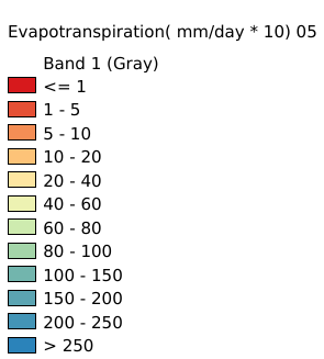
Grid with estimated yearly reference evapotranspiration with a spatial resolution of 10 arc minutes. The dataset contains average values for global land areas, excluding Antarctica, for the period 1961-1990. The dataset has been prepared according to the FAO Penman - Monteith method with limited climatic data as described in FAO Irrigation and Drainage Paper 56. The dataset consists one ASCII-grid with yearly data in mm/year. ASCII-grids with mean monthly data in mm/day * 10 are also available as described in the associated resources of this metadata. Coordinate system: WGS 84. Data source: https://data.apps.fao.org/map/catalog/srv/eng/catalog.search#/metadata/38047053-a960-46b7-98fc-970fc17cd29d
Legend:#
Information:#
Path : /pb1/gisws/qgis_pub_map/svr_w24/local/ch84_Eurasia/sec03_Ecological_Environment/1961_1990_Eurasia_Reference_Evapotranspiration/pub_Eurasia_Reference_Evapotranspiration.qgz
Layer Name : pub_Eurasia_Reference_Evapotranspiration_05_qn2490
Layer ID : qn2490
Center : 35.45832, 4.491497e-09
Zoom : 2