

GeoStyler
GeoStyler is an Open Source JavaScript library that enables users to style maps with the help of a Graphical User Interface. The goal of GeoStyler is a universally applicable GUI that works with any given style format; be it SLD, QML, OpenLayers, etc.
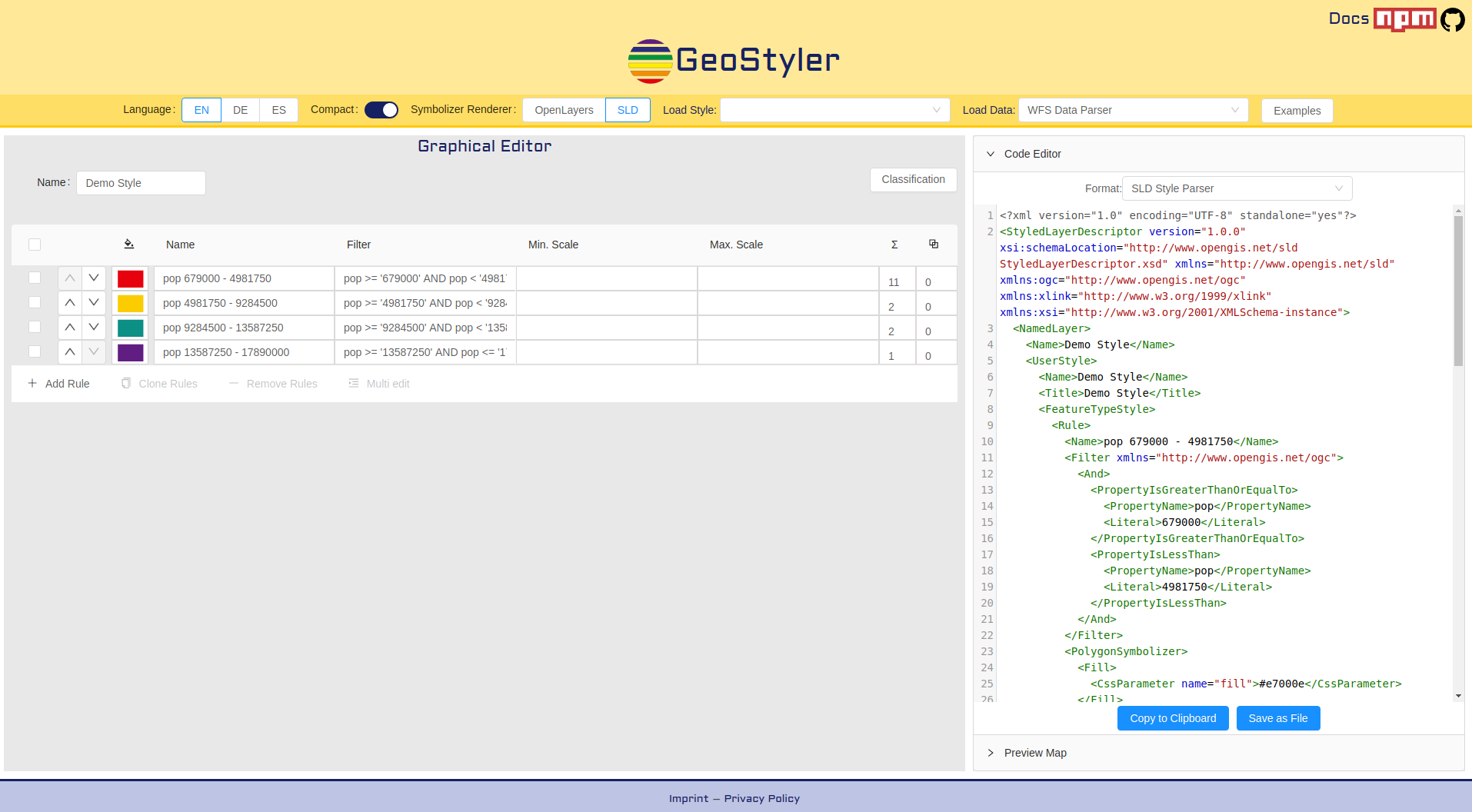
GeoStyler provides a set of UI Components for map styling. Just like a modular building block system all components can be stacked together to create a nice UI for your web applications. To simplify the setup, we also provide some high-level components (based on our building blocks) that already do the work for you. These include, among many others, Symbolizer Editors, RuleTables and a fully-fledged StyleEditor including filters and scale denominators.
Furthermore, GeoStyler allows for the translation between multiple styling formats, i.e. SLD, OpenLayers, QGIS, Mapbox. Since we are following the concept of micro packages, these translators (we call them parsers) can be used as standalone libraries, without the need to include the UI components as a dependency. Currently we have parsers for SLD, QGIS-styles, Mapbox styles and OpenLayers styles. Parsing of Mapfiles is in the works. Please take a look at StyleParser Implementations. Since attributively styling geodata is easier when you can look at the data to be styled, we can connect to several datasources like WFS, Shapefiles and GeoJSON files. We plan on developing a data reader for the Geopackage format.
核心特征
- 通用-不绑定到一种格式
- 已经支持通用格式
- 图形用户界面(GUI)包括对规则重新排序的支持、地图视图、颜色和符号选择器等
- 有一个图形用户界面-但你不需要使用它
- 可扩展-我们邀请您构建自己的数据读取器或解析器
- 继续增长-我们正在计划新特性(如命令行接口、更多解析器等)和一些小的改进
执行的标准
细节
Website: https://geostyler.org
Licence: BSD-2条款
软件版本: 5.4.0
支持: 关于https://github.com/geostyler/geostyler
开发人员: https://github.com/geostyler/geostyler/graphs/contributors