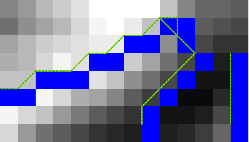
栅格到矢量线
栅格到矢量线
 import ogr, gdal, osr, os
import numpy as np
import itertools
from math import sqrt,ceil

def pixelOffset2coord(rasterfn,xOffset,yOffset):
    raster = gdal.Open(rasterfn)
    geotransform = raster.GetGeoTransform()
    originX = geotransform[0]
    originY = geotransform[3]
    pixelWidth = geotransform[1]
    pixelHeight = geotransform[5]
    coordX = originX+pixelWidth*xOffset
    coordY = originY+pixelHeight*yOffset
    return coordX, coordY

def raster2array(rasterfn):
    raster = gdal.Open(rasterfn)
    band = raster.GetRasterBand(1)
    array = band.ReadAsArray()
    return array

def array2shp(array,outSHPfn,rasterfn,pixelValue):

    # max distance between points
    raster = gdal.Open(rasterfn)
    geotransform = raster.GetGeoTransform()
    pixelWidth = geotransform[1]
    maxDistance = ceil(sqrt(2*pixelWidth*pixelWidth))
    print maxDistance

    # array2dict
    count = 0
    roadList = np.where(array == pixelValue)
    multipoint = ogr.Geometry(ogr.wkbMultiLineString)
    pointDict = {}
    for indexY in roadList[0]:
        indexX = roadList[1][count]
        Xcoord, Ycoord = pixelOffset2coord(rasterfn,indexX,indexY)
        pointDict[count] = (Xcoord, Ycoord)
        count += 1

    # dict2wkbMultiLineString
    multiline = ogr.Geometry(ogr.wkbMultiLineString)
    for i in itertools.combinations(pointDict.values(), 2):
        point1 = ogr.Geometry(ogr.wkbPoint)
        point1.AddPoint(i[0][0],i[0][1])
        point2 = ogr.Geometry(ogr.wkbPoint)
        point2.AddPoint(i[1][0],i[1][1])

        distance = point1.Distance(point2)

        if distance < maxDistance:
            line = ogr.Geometry(ogr.wkbLineString)
            line.AddPoint(i[0][0],i[0][1])
            line.AddPoint(i[1][0],i[1][1])
            multiline.AddGeometry(line)

    # wkbMultiLineString2shp
    shpDriver = ogr.GetDriverByName("ESRI Shapefile")
    if os.path.exists(outSHPfn):
        shpDriver.DeleteDataSource(outSHPfn)
    outDataSource = shpDriver.CreateDataSource(outSHPfn)
    outLayer = outDataSource.CreateLayer(outSHPfn, geom_type=ogr.wkbMultiLineString )
    featureDefn = outLayer.GetLayerDefn()
    outFeature = ogr.Feature(featureDefn)
    outFeature.SetGeometry(multiline)
    outLayer.CreateFeature(outFeature)


def main(rasterfn,outSHPfn,pixelValue):
    array = raster2array(rasterfn)
    array2shp(array,outSHPfn,rasterfn,pixelValue)

if __name__ == "__main__":
    rasterfn = 'test.tif'
    outSHPfn = 'test.shp'
    pixelValue = 0
    main(rasterfn,outSHPfn,pixelValue)
说明:
这个方法将栅格像素转换为具有指定值的矢量线。例如,蓝色像素(值= 0)被转换为矢量线。

关注公众号
获取免费资源