OGC API-EDR的区域查询资源
区域是用可能具有垂直尺寸的地理包络指定的区域。使用NASA WorldWind制作的插图如下所示。
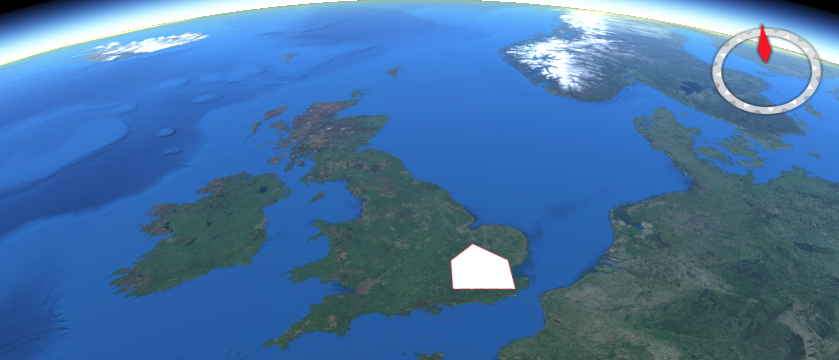
这个 area 查询资源返回定义区域的数据。该资源提供了一种使用熟知文本(WKT)多边形几何体按区域查询API的方便机制。
资源的路径如下所示:
/collections/{collectionId}/area
路径接受以下参数:
余弦
Z
参数名称
日期时间
CRS
F
下面显示了一个示例请求。
http://example.org/edr/collections/gfs-pressure_at_height/area?coords=POLYGON((-0.898132%2051.179362,-0.909119%2051.815488,0.552063%2051.818884,0.560303%2051.191414,-0.898132%2051.179362))¶meter-name=Pressure_height_above_ground&datetime=2022-01-19T06:00Z/2022-01-19T12:00Z&z=80/80&crs=CRS84&f=CoverageJSON